[youtube]http://youtu.be/HjTSDuOSCWc[/youtube]Dr. William J. Fritz has gathered an interdisciplinary group of College of Staten Island (CSI) faculty colleagues to conduct long-term research on the impact of future superstorms in the New York area.
Dr. Fritz, geologist and Interim President of CSI, serves as the spokesperson for the team. He is joined by geologist, Dr. Alan Benimoff, who has been using a Geographic Information System (GIS) to analyze the role of urbanization in hurricane zones on the Island, and study post-storm surge and flooding data; Professor of Political Science Dr. Richard Flanagan, who has been “explaining to the press the political, intergovernmental, and leadership questions related to the impact of the storm and the recovery effort”; Finance Professor Dr. Jonathan Peters, who is investigating the economic impact of the storm and post-Sandy planning and re-zoning; and Vice President for Technology Systems Dr. Michael Kress, who is employing The City University of New York’s state-of-the-art High-Performance Computing Center housed on the CSI campus to develop and run the storm surge computer models.
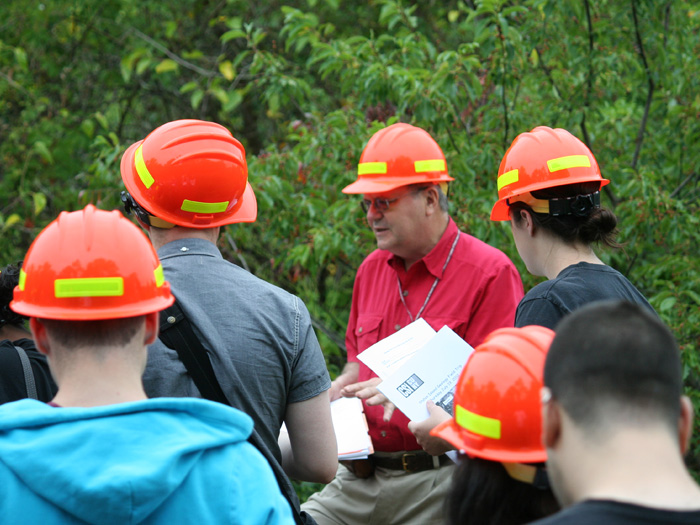
CSI Interim President and geologist Dr. William Fritz joins Dr. Alan Benimoff to lead a geological tour of Staten Island Summer 2012.
Underscoring the importance of taking a multifaceted approach to this research, Dr. Fritz presented his Five-Point Plan earlier this month at the Municipal Art Society of New York conference, “Charting the Road to Resilience,” at The New School, and The Museum of The City of New York‘s first installment of their Aftermath series entitled “The Future of Staten Island after Sandy.” The conference experience has informed the planning process for the College of Staten Island’s upcoming Superstorm Sandy Forum: “A Serious Conversation about the Future of Staten Island,” scheduled for Friday, March 8, 2013.
Dr. Fritz explains that “the common theme associated with every disaster I’ve worked with is geologists come in and predict what is going to happen [but people seldom listen or take any action]. My thinking was that we needed to broaden our research to have an interdisciplinary team—get a political scientist to ask what are the challenges, legal issues, and social and political implications of re-zoning, and an expert on finance to determine what are the economic impacts to the community. This has been evolving since Sandy happened, the need to make this a broader discussion…I want the conversation that we have on Staten Island to be an interdisciplinary one.”
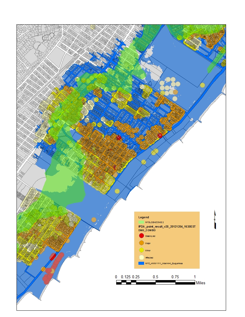
GIS Map of Hurricane Sandy's impact by Dr. Alan Benimoff.
Dr. Fritz has been working on the geological consequences of future storms with Dr. Benimoff since Hurricane Irene hit our portion of the East Coast in 2011, and he called that storm a “wake-up call” to alert people to the fact that the hurricane belt does, indeed, reach far to the north of North Carolina. The scientists have also been busy developing an extended database and modeling system that blends with a system that was already in place for the southern portion of the East Coast, which was created at the Renaissance Center at the University of North Carolina.
“What we’ve done,” Dr. Fritz notes, “is taken data from the shipping charts and water topography of the New York area and blended it with the same North Carolina database. We think that we now have one of the most complete computer models for the Eastern Seaboard that goes from Connecticut as far south as North Carolina. That’s something that will be indefinitely refined as we get more and more data. For example, as a surge comes ashore, if you have a dredged shipping channel, that’s going to change the dynamics of the flow of the ocean. As you get more and more data, you continue to get a better model to predict exactly where the flooding will take place. The other thing I want to start doing is exploring “what if” models and say, suppose it was a Category 3 hurricane, but it hit as the tide was going out, so how does one water flow cancel out the other? We’ve just scratched the surface as to what we could be doing with those predictive models.”
Reemphasizing the importance of the interdisciplinary aspects of the research, he adds, “The other thing that I want to do is expand into is a conversation about re-zoning, about economic development, and protection of barrier islands and wetlands. So, I see this as being a long-term research project or series of research projects.
As the work continues, Dr. Fritz has so far been featured on a number of media outlets to discuss the group’s research, such as the Staten Island Advance, The New York Times, WABC-TV, The Huffington Post, CUNY-TV, and Staten Island Cable Television.